Delaware River
| Delaware River | |
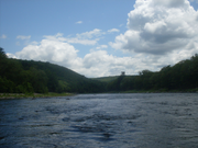
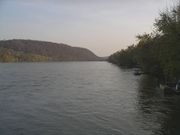
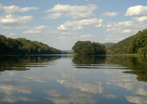 Delaware River above the Delaware Water Gap
|
|
| Country | United States |
|---|---|
| States | New York, New Jersey, Pennsylvania, Delaware |
| Tributaries | |
| - left | Neversink River, Musconetcong River |
| - right | Lehigh River, Schuylkill River |
| Cities | Port Jervis, NY, Easton, PA, Trenton, NJ, Camden, NJ, Philadelphia, PA, Wilmington, DE |
| Source | West Branch |
| - location | Mount Jefferson, Town of Jefferson, Schoharie County, New York, USA |
| - elevation | 2,240 ft (683 m) |
| - coordinates | |
| Secondary source | East Branch |
| - location | Grand Gorge, Town of Roxbury, Delaware County, New York, United States |
| - elevation | 1,560 ft (475 m) |
| - coordinates | |
| Source confluence | |
| - elevation | 880 ft (268 m) |
| - coordinates | |
| Mouth | Delaware Bay |
| - elevation | 0 ft (0 m) |
| - coordinates | |
| Length | 360 mi (579 km) |
| Basin | 14,119 sq mi (36,568 km²) |
| Discharge | for Trenton |
| - average | 13,100 cu ft/s (371 m3/s) |
| - max | 64,800 cu ft/s (1,835 m3/s) |
| - min | 4,310 cu ft/s (122 m3/s) |
| Discharge elsewhere (average) | |
| - Port Jervis | 7,900 cu ft/s (224 m3/s) |
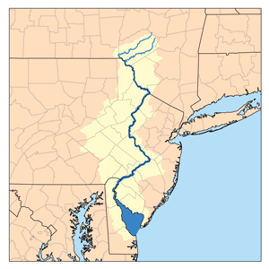 Delaware River (and Delaware Bay) watershed
|
|
The Delaware River is a major river on the Atlantic coast of the United States. The Delaware was explored by Adriaen Block as part of the New Netherlands Colony, and was named the South River to mark the southernmost reach of that colony.
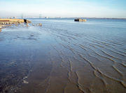
The river meets tide-water at Trenton, New Jersey. Its total length, from the head of the longest branch to Cape May and Cape Henlopen, is 410 miles (660 km), and above the head of the Delaware Bay its length is 360 miles (579 km). The mean freshwater discharge of the Delaware River into the estuary is 11,550 cubic feet (330 m³) per second.
The Delaware River constitutes, in part, the boundary between Pennsylvania and New York, the entire boundary between New Jersey and Pennsylvania, and most of the boundary between Delaware and New Jersey. The Delaware-New Jersey Border is actually at the eastern-most river shoreline within the Twelve-Mile Circle of New Castle, rather than the usual mid river or mid channel borders, causing small portions of the New Jersey peninsula falling west of the shoreline to fall under the jurisdiction of Delaware. The rest of the borders follow a mid-channel approach.
Commerce was once important on the upper river, primarily prior to railway competition (1857).
- The Delaware Division of the Pennsylvania Canal, running parallel with the river from Easton to Bristol, opened in 1830.
- The Delaware and Raritan Canal, which runs along the New Jersey side of the Delaware River from Milford to Trenton, unites the waters of the Delaware and Raritan rivers as it empties the waters of the Delaware River via the canal outlet in New Brunswick. This canal water conduit is still used as a water supply source by the State of New Jersey.
- The Morris Canal (now abandoned and almost completely filled in) and the Delaware and Hudson Canal connected the Delaware and Hudson rivers.
- The Chesapeake and Delaware Canal joins the waters of the Delaware with those of the Chesapeake Bay.
The mean tides below Philadelphia are about 6 feet (1.8 m). The magnitude of the commerce of Philadelphia has made the improvements of the river below that port of great importance. Small improvements were attempted by Pennsylvania as early as 1771.
In the "project of 1885" the United States government undertook systematically the formation of a 26-foot (7.9 m) channel 600 feet (180 m) wide from Philadelphia to deep water in Delaware Bay. The River and Harbor Act of 1899 provided for a 30-foot (9.1 m) channel 600 feet wide from Philadelphia to the deep water of the bay.
Contents |
Course
The main, west or Mohawk branch rises in Schoharie County, New York, about 1,886 feet (575 m) above the sea, near Mount Jefferson, and flows tortuously through the plateau in a deep trough, impounded at one point to create the Cannonsville Reservoir, and then becoming the state boundary of N.Y and Pennsylvania at the 42nd parallel, until it emerges from the Catskills. Similarly, the East Branch begins from a small pond south of Grand Gorge in the town of Roxbury in Delaware County, flowing southward toward its impoundment by New York City to create the Pepacton Reservoir, the largest reservoir in the New York City water supply system. The confluence is just south of Hancock.
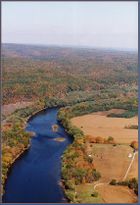
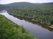
From Hancock, NY the river flows between the Pocono plateau and the raised shale beds south of the Catskills. The river flows down a broad Appalachian valley, passing Hawk's Nest overlook on the "Upper Delaware Scenic Byway". At Port Jervis it enters the Port Jervis trough. Below Port Jervis, New York, the Walpack Ridge deflects the Delaware into the Minisink Valley, where it follows the southwest strike of the eroded Marcellus Formation beds along the Pennsylvania–New Jersey state line for 25 miles (40 km) to the end of the ridge at Wallpack Bend in the Delaware Water Gap National Recreation Area.[1][2] The Minisink is a buried valley where the Delaware flows in a bed of glacial till that buried the eroded bedrock during the last glacial period. It then skirts the Kittatinny ridge, which it crosses at the Delaware Water Gap, between nearly vertical walls of sandstone, quartzite, and conglomerate and then passes through a quiet and charming country of farm and forest, diversified with plateaus and escarpments, until it crosses the Appalachian plain and enters the hills again at Easton, Pennsylvania. From this point it is flanked at intervals by fine hills, and in places by cliffs, of which the finest are the Nockamixon Rocks, 3 miles (5 km) long and above 200 feet (61 m) high.
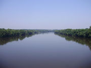
At Trenton there is a fall of 8 feet (2.4 m). Below Trenton the river flows between Philadelphia and New Jersey before becoming a broad, sluggish inlet of the sea, with many marshes along its side, widening steadily into its great estuary, Delaware Bay.
Tributaries
Its main tributaries in New York are the Mongaup and Neversink rivers and Callicoon Creek; from Pennsylvania, the Lackawaxen, Lehigh, and Schuylkill rivers; and from New Jersey, Rancocas Creek and the Musconetcong and Maurice rivers. Oldmans and Raccoon creeks are tributaries in New Jersey.
- Appoquinimink River
- Alloway Creek
- Assiscunk Creek
- Assunpink Creek
- Big Timber Creek
- Blacks Creek
- Brodhead Creek
- Bushkill Creek
- Chester Creek
- Christina River
- Cooper River (New Jersey)
- Crafts Creek
- Crosswicks Creek
- Crum Creek
- Darby Creek
- Equinunk Creek
- Flat Brook
- Frankford Creek
- Lehigh River
- Lockatong Creek
- Mantua Creek
- Maurice River
- Musconetcong River
- Neshaminy Creek
- Neversink River
- Newton Creek (New Jersey)
- Oldmans Creek
- Paulins Kill
- Pennypack Creek
- Pequest River
- Pompess Creek
- Pohatcong Creek
- Poquessing Creek
- Raccoon Creek (New Jersey)
- Rancocas Creek
- Ridley Creek
- Salem River
- Schuylkill River
- Shohola Creek
- Tohickon Creek
- Wickecheoke Creek
- Woodbury Creek
Flooding
The Delaware has experienced a number of serious flooding events as the result of snow melt and/or rain run-off from heavy rainstorms. Record flooding occurred in August 1955, in the aftermath of the passing of the remnants of two separate hurricanes over the area within less than a week: first Hurricane Connie and then Hurricane Diane, which was, and still is, the wettest tropical cyclone to have hit the northeastern United States. The river gauge at Riegelsville, PA recorded an all time record crest of 38.85 feet (11.84 m) on August 19, 1955.
More recently, moderate to severe flooding has occurred along the river. The same gauge at Riegelsville recorded a peak of 30.95 feet (9.43 m) on September 23, 2004, 34.07 feet (10.38 m) on April 4, 2005, and 33.62 feet (10.25 m) on June 28, 2006, all considerably higher than the flood stage of 22 feet (6.7 m).[3]
Since the upper Delaware basin has few population centers along its banks, flooding in this area mainly affects natural unpopulated flood plains. Residents in the middle part of the Delaware basin experience flooding, including three major floods in the three years (2004–2006) that have severely damaged their homes and land. The lower part of the Delaware basin from Philadelphia southward to the Delaware Bay is tidal and much wider than portions further north, and is not prone to river related flooding (although tidal surges can cause minor flooding in this area).
The Delaware River Basin Commission, along with local governments, is working to try to address the issue of flooding along the river. As the past few years have seen a rise in catastrophic floods, most residents of the river basin feel that something must be done. The local governments have worked in association with PHEMA to address many of these problems, however, due to insufficient federal funds, progress is slow.[4]
New York City Water Supply
After New York City had made 15 reservoirs (with more to come) for their water supply, and with a growing population, the city tried to gain permission to make five reservoirs along the Delaware River's tributaries. However, they were denied the permission to impound the Delaware's tributaries to make new reservoirs. So in 1928, New York City decided to draw water from the Delaware River to feed the population boom that had started during the beginning of the Great Depression. There were, however, villages and towns across the river in Pennsylvania that were already using the Delaware for their water supply. The two sides eventually took their case to the U.S. Supreme Court, and in 1931, New York City was finally allowed to draw 440 million gallons of water a day from the Delaware and its upstream tributaries.
Crossings
The Delaware River is a major barrier to travel between New Jersey and Pennsylvania. Most of the larger bridges are tolled only westbound, and are owned by the Delaware River and Bay Authority, Delaware River Port Authority, Burlington County Bridge Commission or Delaware River Joint Toll Bridge Commission.
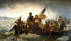
Washington's crossing of the Delaware
Perhaps the most famous “Delaware Crossing” involved the improvised boat crossing undertaken by George Washington’s army during the American Revolution on Christmas Day, 1776. This led to a successful surprise attack on the Hessian troops occupying Trenton, New Jersey.
Major oil spills
A number of oil spills have taken place in the Delaware over the years.[5][6][7]
- 01-31-1975 — 11,000,000 gallons of crude oil spilled from the Corinthos tanker
- 09-28-1985 — 435,000 gallons of crude oil spilled from the Grand Eagle tanker after running aground on Marcus Hook Bar
- 06-24-1989 — 306,000 gallons of crude oil spilled from the Presidente Rivera tanker after running aground on Claymont Shoal
- 11-26-2004 — 265,000 gallons of crude oil spilled from the Athos 1 tanker; the tanker's hull had been punctured by a submerged, discarded anchor
See also
- Foul Rift, rapids just south of Belvidere, New Jersey
- List of Delaware rivers
- List of New Jersey rivers
- List of New York rivers
- List of Pennsylvania rivers
- Partnership for the Delaware Estuary
- Tocks Island
- Upper Delaware Scenic and Recreational River
- Washington Crossing
- Geography of Pennsylvania
Notes
- ↑ White, Ron W.; Monteverde, Donald H. (02-01-2006). "Karst in the Delaware Water Gap National Recreation Area" (pdf). Unearthing New Jersey Vol. 2, No. 1. New Jersey Geological Survey. http://www.njgeology.org/enviroed/newsletter/v2n1.pdf. Retrieved 06-07-2008.
- ↑ White, I.C.; Chance, H.M. (1882). The geology of Pike and Monroe counties. Second Geol. Surv. of Penna.,. Rept. of Progress, G6. Harrisburg. pp. 17, 73–80, 114–115.
- ↑ USGS See Also: (State of New Jersey: Recent flooding events in the Delaware river basin
- ↑ Delaware River Basin Commission (2005-07-20). "Delaware River Basin Commission’s Role in Flood Loss Reduction Efforts." West Trenton, NJ.
- ↑ "Athos 1 Oil Spill". University of Delaware Sea Grant Program. 03-11-2005. http://www.ocean.udel.edu/oilspill/. Retrieved April 29, 2006.
- ↑ "1985 Grand Eagle Oil Spill". University of Delaware Sea Grant Program. 12-16-2004. http://www.ocean.udel.edu/oilspill/Grandeagle.html. Retrieved April 29, 2006.
- ↑ "Presidente Rivera Spill – June 24, 1989". University of Delaware Sea Grant Program. 2004-12-08. http://www.ocean.udel.edu/oilspill/PresidenteRiveraSpill.html. Retrieved April 29, 2006.
References
 This article incorporates text from a publication now in the public domain: Chisholm, Hugh, ed (1911). Encyclopædia Britannica (Eleventh ed.). Cambridge University Press.
- Devastation on the Delaware: Stories and Images of the Deadly Flood of 1955 (2005, Word Forge Books, Ferndale, PA) The only comprehensive documentary of this weather disaster in the Delaware River Valley.
External links
- Delaware River Basin Commission
- Delaware Riverkeeper Network
- National Park Service: Delaware Water Gap National Recreation Area
- National Park Service: Upper Delaware Scenic & Recreational River
- National Park Service: Lower Delaware Wild & Scenic River
- U.S. Geological Survey: NJ stream gaging stations
- U.S. Geological Survey: NY stream gaging stations
- U.S. Geological Survey: PA stream gaging stations
|
|||||||||||||||||||||||